Top 5 Trail Recommendations around Aigeira
Within approx. 50 km (30 miles) from Aigeira the visitor has the choice of several treks and hikes for all abilities. From relatively easy, to hard-core for the very fit hiking enthusiasts.
In this article we will present our Top 5 recommendations to suit all. The list is by no means exhustive, and you should be able to disover more options with a few online searches.
1. Easy: Peristerionas Gorge
GRE: Φαράγγι Περιστεριώνα, Ακράτα, Ποταμός Κράθης
This is the closest and easiest choice for anyone wanting to spend 1-2 hrs enjoying nature in a very accessible way.
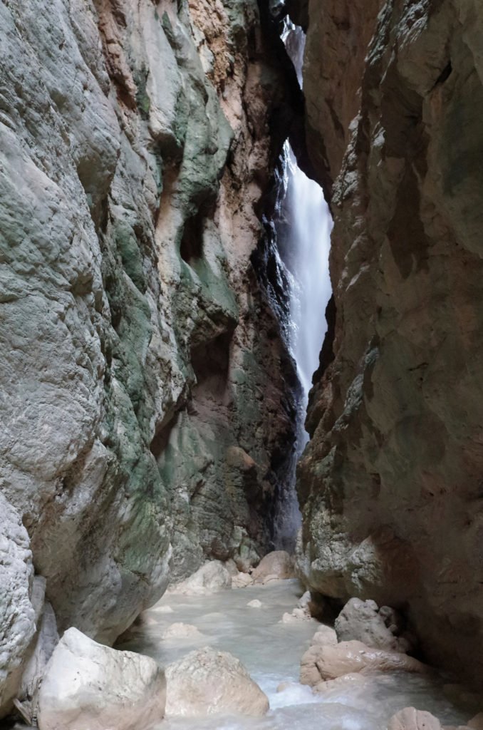
Peristerionas Gorge is a natural formation of approximately 500m along river Krathis near the town of Akrata (upper Akrata, not Paralia), just a few minutes by car, although it can be accessed by foot even from the coast.
There are two variations of this river trek, which depend on which way you approach the gorge.
The easiest is heading south way (i.e. against the natural flow of the river) thus entering the north side of the gorge.
If you chose this option you will not be able to cross the whole length of the gorge due to a relatively short but difficult to climb waterfall (requires rapel). You will nonetheless get a great appreciation of the natural forces that have carved the slopes of the mountain over thousand of years and have created a magnificent spectacle with relatively little effort from your side.
Below is the hiking route at wikiloc.om from user gertzos

If you start your hike entering from the south side of the gorge, thus following the natural flow of river Krathis, you will be rewarded for your additional effort especially during the wetter months as there is a wonderful shower mist from water cascading the dome of the gorge at its narrowest point.
Below is the hiking route at wikiloc.om from user gertzos

Here is a video of the gorge from Christos Panagiotou
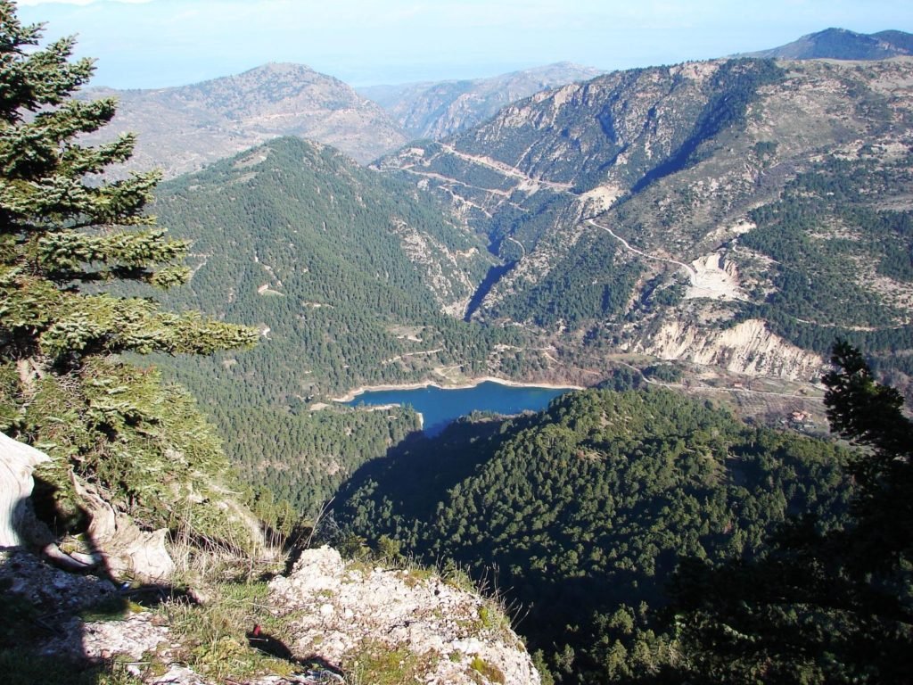
2. Moderate-Easy: Tsivlos Lake to Plateau Stolos
If the aforementioned trek feels to easy for your preferences or you prefer the trails then have a look at an alternative option below. This is a more moderate trail of approx 12 km length at the surrounding slopes of Lake Tsivlou (or Tsivlos) up to Plateau Stolos at 1,520m.
Below is the hiking route at wikiloc.om from user spas00

Here is the trail map at wikiloc.com.
3. Moderate: Vouraikos Gorge along Odontotos (world’s narrowest rail track).
This route is part of the E4 European Long Distance Hiking Route. There are a few variations that one can try ranging from a fairly easy 16km walk (illustrated below), up to completing the whole 50km round-trip from Diakopto to Kalavryta.

As mentioned, the easiest and also the most scenic option is the part of the gorge from Zachlorou walking down to Diakopto following the famous Odontotos (Rack) Railway, which with a gauge of only 0,75m makes it the narrowest in the world.
Time Required: The distance is approx. 16km and should take you around 3-4hrs.
The tracks pass through iconic points of Vouraikos gorge, such as the Gates (greek: “Portes”), waterfalls, rail bridges along the river. The hike is easy and only downhill.
| From Diakopto | From Kalavrita |
| 09:05 – Daily 11:30 – Daily 12:49 – Weekends 14:05 – Daily 15:30 – Weekends | 10:17 – Daily 12:43 – Daily 14:03 – Weekends 15:28 – Daily 17:23 – Weekends |
Attention:
Although the route is fairly easy please be aware of it’s risk factor as there is no pedestrian path and you would be walking along a narrow train track, crossing bridges constructed exclusively for the train with no safety barriers.Do check the time table of the train for the whole day, both ways, to avoid meeting the train in the tunnels. It is also recommended to report your hike to the train authorities at the station in Diakopto in order to worn the train operator.


Aigeira – Hiking – Odontotos Trail – Dangerous Spots or Passages (photo Artemis Klonos)
For more information about odontotos check out the official website here.
Also another article (in english) with the first hand experience and info about hiking the route from Alex here.
4. Advanced: Styx Waters Trail – Helmos Observatory at Mount Aroania
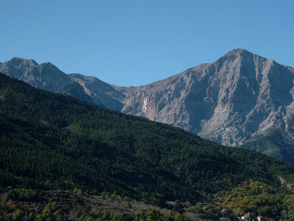
The most well known trail in the region is the Styx Waters Trail at Mount Aroania (2,355m / 7,726 ft), the 3rd highest mountain of the Peloponnese.

The mountain is the site of the Aristarchos telescope and of the Kalavryta Ski Resort. Points of interest on the mountain include the Styx Waterfall, the Lake Caves, the monastery of Mega Spilaio and the mountain town Kalavryta. Some of villages on the mountain are Planitero and Peristera.
There is a very well written article (in english) about the Styx Waters Trail at Mount Aroania over at hikingexperience.gr which provides a lot of information about the trail should you wish to complete it yourselves.
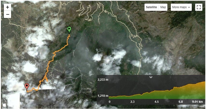
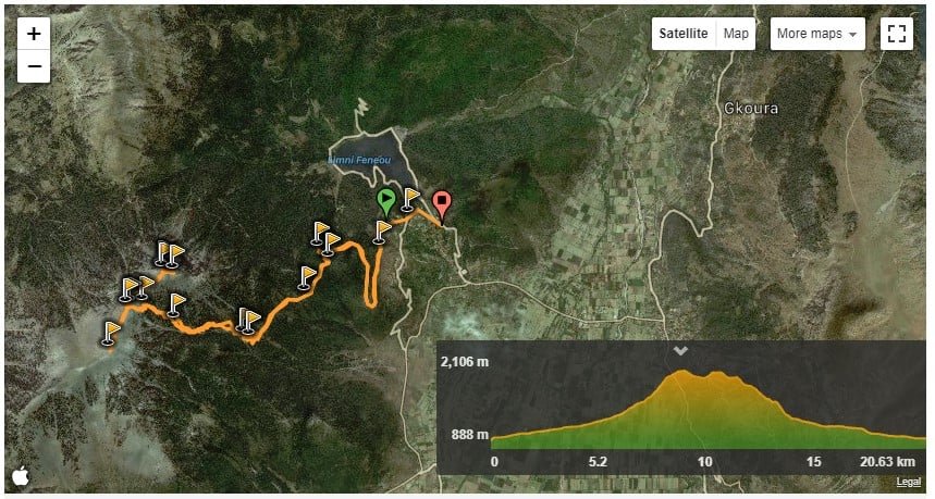
5. Hard: Lake Doxa – Dourdouvana/Triantafilia Peak
For fitter hikers there is the option of hiking from Lake Doxa (Feneos) to the surrounding southern peaks of Mountain Aroania, Dourdouvana (2,078 m-6,817 ft) and Triantafilia (2,109 m-6,919 ft).
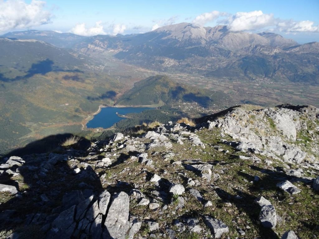
This is a demanding 20+ km trail that starts at about 900m and you ascend at approx. 2,100m. For more information about this trail check the link here.
Something Different
If you would prefer something different and do not mind driving along a winding road, you can always visit one of the villages south of Aigeira, most notably Perithorio or Seliana and enjoy a walk around the nearby forest that surrounds them.
These villages sit at an altitude of approx. 900m thus enjoying much cooler temperatures during the year than Aigeira, allowing lush flora to flourish. The local forest consists of mainly conifers.
Google Map: Perithorio village (22km/14miles away).

